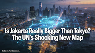

When a “City” Changes Overnight: Megacities, New Maps, and a Sinking Capital
What happens when the world updates its measuring tape — and a city “grows” by tens of millions overnight?
Welcome, friends. At FreeAstroScience.com we explain complex scientific
principles in simple terms, and we wrote this piece with you in mind — whether
you’re reading it at your desk, on a crowded train, or squeezed onto a bus at
7 a.m. We want your mind active, your curiosity sharp. As we always say here:
the sleep of reason breeds monsters. Keep reading to the end, and we promise
you’ll come away with a genuinely different picture of what a “city” really is,
why Jakarta now tops the UN’s population rankings, and why one of Earth’s
largest cities is, quite literally, sinking.
Degree of Urbanization (DEGURBA)
Megacities 2025
Jakarta land subsidence
GRACE & InSAR satellites
Nusantara capital relocation
Did Jakarta really overtake Tokyo?
Yes — at least according to the United Nations’ most current data.
The World Urbanization Prospects 2025, released on 18 November 2025,
places Jakarta at nearly 42 million residents, making it the
world’s most populous city for the first time in recorded UN statistics.
Dhaka, Bangladesh’s capital, ranks second at roughly 40 million,
while Tokyo drops to third at 33 million.
If this feels surprising, that’s fair. For decades, “Tokyo is the biggest city
on Earth” felt like a fixed fact — the kind you’d drop confidently in a quiz night.
But facts, it turns out, depend on the ruler you’re using. The shift from Tokyo
to Jakarta isn’t purely about population growth; it’s also about a fundamental
change in how the UN measures what counts as “urban” in the first place.
The UN itself adds a useful caveat: megacities capture all the headlines, but
small and medium-sized cities hold more total people and are growing faster across
much of the world. The Jakarta story is dramatic, yet it’s really just one dot in
a much bigger picture.
What does “city” actually mean in the new UN method?
The 2025 edition of World Urbanization Prospects adopts the
Degree of Urbanization — a harmonized, geospatial framework
agreed upon by the UN Statistical Commission. Instead of relying on each country’s
own administrative definitions (which vary wildly), it starts from satellite-based
population grids and draws boundaries based on density and connected built-up area.
The practical result is dramatic: the minimum population threshold for
“urban centres” (cities) dropped from 300,000 in previous editions to just 50,000.
That single change expanded the global city list from a few thousand to over
12,000 urban centres. Places that were invisible in older reports
suddenly appeared on the map.
For Jakarta, this meant that dense, interconnected informal settlements —
the kampungs that ring the city’s core — were counted as part of the
same continuous urban fabric. Millions of people who were previously invisible
in the statistics became visible. That’s not a trick; it’s arguably a long-overdue
correction.
| Settlement type | Density threshold | Minimum population | What changes in practice |
|---|---|---|---|
| City | Contiguous 1 km² grid cells > 1,500 inhabitants per km² | ≥ 50,000 | Dense connected areas — including informal settlements — merge into one comparable city shape |
| Town / semi-dense area | Contiguous grid cells ≥ 300 inhabitants per km² | ≥ 5,000 | Captures everyday urban life well outside downtown cores that older methods missed |
| Rural area | Mostly low-density cells (< 300 inhabitants per km²) | No single cut-off | Enables fair comparison across countries with very different national statistical traditions |
Think of it like switching from hand-drawn district maps to a satellite photograph.
The ground didn’t change. Our ability to see it clearly did.
Why are megacities multiplying so fast?
The UN defines a “megacity” as an urban area with at least
10 million inhabitants. In 1975, only 8 cities crossed that line.
By 2025, the count stands at 33 megacities — a fourfold increase
in half a century. Nineteen of those 33 sit in Asia.
The global picture is equally striking. Cities now house
45% of the world’s 8.2 billion people, up from just 20% of a much
smaller 2.5 billion in 1950. The UN expects that two-thirds of all population
growth between now and 2050 will happen in cities — mostly in Africa and Asia.
By 2050, the UN projects at least 37 megacities. Cities on the
cusp of joining that club include Addis Ababa, Dar es Salaam, Hajipur, and
Kuala Lumpur. Meanwhile, Tokyo’s population is already on a slow decline — a
reflection of Japan’s ageing demographics rather than urban failure. Dhaka, on
the other hand, may claim the top spot by 2050.
What drives all this? Rural-to-urban migration, higher birth rates in younger
city populations, the pull of economic opportunity, and — crucially — improved
data collection that finally counts the people who were always there but never
tabulated. The megacity boom is real, but part of it is also us getting better
at looking.
What environmental pressures threaten Jakarta right now?
A city’s rank in a UN table is just a number. What happens on the ground is another
story entirely — and for Jakarta, that story involves water, gravity, and a race
against time.
Why is Jakarta sinking?
A geotechnical study presented at the 2019 European Conference on Soil Mechanics
and Geotechnical Engineering (ECSMGE) documents severe land subsidence across
Jakarta, with maximum recorded rates exceeding 20 mm per year
and cumulative settlement of more than 3 meters in the city’s
northern districts.
The primary driver is excessive groundwater extraction. When groundwater is pumped
out faster than natural recharge can replace it, the aquifer compacts — and the
ground above it drops. The same study records a groundwater level decline of up
to 25 meters in central Jakarta, based on monitoring data
collected through 2014.
The infrastructure gap amplifies the problem. The piped water network serves
roughly 40% of the city’s population, while the sewer network
covers a mere 4%. Where clean piped water is unavailable,
residents and businesses — including hotels and office buildings — fall back on
private wells. Analysts estimate nearly 5,000 undocumented wells operate across
the metropolitan area. Each one draws a little more water from the ground beneath
one of the world’s most populated cities.
How close is the worst-case scenario?
About 40% of Jakarta already lies below sea level. Predictive
models cited in water-science literature warn that, without intervention, much
of the city could be submerged by 2050. Satellite-based analyses using synthetic
aperture radar show subsidence rates reaching up to 26 cm per year
in the most heavily affected coastal zones of the greater Jakarta region.
Combine sinking land with rising seas — driven by global warming — and the
coastal flood risk accelerates. The question isn’t purely hypothetical.
In 2007, Jakarta experienced catastrophic flooding that displaced hundreds of
thousands of people. That event was a preview, not an anomaly.
Is the new capital Nusantara a solution?
Indonesia’s government is building a new capital city called
Nusantara in the East Kalimantan province of Borneo,
at an estimated cost of over $30 billion USD.
The plan aims to relocate government ministries and roughly
1.9 million people — mainly civil servants and their families —
away from the sinking, flood-prone, congested Jakarta.
But the scheme raises serious equity questions. Jakarta’s population won’t
disappear because a new administrative capital opens 1,200 km away.
Tens of millions of people will remain, and the environmental pressures will
remain with them. Critics argue that without parallel investment in water
infrastructure, groundwater regulation, and coastal protection for Jakarta itself,
Nusantara may address the government’s logistical headache while leaving
everyone else behind.
How do satellites track a city’s slow-motion crisis?
Here’s where our love for space science meets urgent human geography. Jakarta
shows us something profound: a crisis that moves in millimeters per year can
still reshape millions of lives over decades. And the best tools for tracking
it orbit silently overhead.
Weighing the Earth’s water from orbit
NASA’s GRACE and GRACE Follow-On satellites
measure tiny changes in Earth’s gravitational field as water masses shift around
the planet. When groundwater is extracted from a region, total water storage
decreases, and the satellites detect a slight drop in local gravity.
By comparing measurements over months and years, scientists can reconstruct how
groundwater reserves are changing — even in places where no wells or gauges
exist on the ground.
The calculation uses a water-bookkeeping relationship. If we call total
terrestrial water storage change ΔTWS, and we subtract the
contributions from surface water, soil moisture, and snow, what’s left must
be groundwater change:
MathML + plain-text fallback
Key:
ΔWgw = groundwater change ·
ΔTWS = total terrestrial water storage change ·
ΔWsw = surface water change ·
ΔWsoil = soil moisture change ·
ΔWsnow = snow water equivalent change
Think of it as weighing a sponge from a distance. We can’t squeeze it directly,
but we can tell it’s getting lighter — and that tells us the water is leaving.
Measuring ground movement with radar
InSAR (Interferometric Synthetic Aperture Radar) works by
comparing radar images of the same patch of ground taken weeks or months apart.
The phase difference between two passes reveals surface movement at centimeter
to millimeter precision — good enough to track Jakarta’s gradual but relentless
subsidence over time.
A particular advantage of radar is cloud penetration. Unlike optical cameras,
radar sees straight through cloud cover, day or night. In equatorial, monsoon-prone
Jakarta, that matters enormously. It means scientists can monitor ground movement
consistently across all seasons, not just on clear days.
Together, GRACE and InSAR form a kind of space-based early warning system —
one that was unavailable when Jakarta’s groundwater crisis began decades ago,
but that now gives policymakers real data on which to act. Whether they act on it
is, of course, a human question, not a scientific one.
Where do we go from here?
We’ve covered a lot of ground — quite literally. The UN’s
World Urbanization Prospects 2025 reshuffled the world’s city rankings
by adopting a new, more honest method for measuring urban populations.
Jakarta’s rise to 42 million isn’t a sudden explosion of growth; it’s what
happens when we finally count everyone who was already there.
At the same time, Jakarta’s environmental situation is a sober reminder that
population numbers are just the start of the conversation.
A city of 42 million that is sinking, under-served by clean water, and
perpetually threatened by coastal flooding is a city that demands urgent,
structural, long-term solutions — not just a new capital 1,200 km away.
Megacities are not going away. By 2050, two-thirds of global population growth
will occur in urban areas, many of which face overlapping pressures: climate
change, inequality, ageing infrastructure, and the same invisible
groundwater depletion problem that Jakarta now makes visible to the world.
The cities that find a way through will be the ones that treat their people —
all of them, including those in the informal settlements — as the starting point.
Here at FreeAstroScience.com, we believe that understanding these systems —
from satellite gravity measurements to city-boundary definitions — is not an
academic exercise. It’s how we stay informed, ask better questions, and hold
the right people accountable. Come back to FreeAstroScience.com whenever you
want to grow your knowledge and keep your mind working. We’ll always be here,
making the complex simple — because we never want you to stop thinking.
Sources
-
United Nations DESA — World Urbanization Prospects 2025: Summary of Results (released 18 November 2025) —
un.org/en/desa/latest-urbanization-data… -
World Bank Blog — “How do we define cities, towns, and rural areas?” (Degree of Urbanization thresholds) —
blogs.worldbank.org -
UN DESA — What’s New: WUP 2025 (methodology changes; threshold shift; 12,000+ urban centres) —
undesa_pd_2025_whatsnew_wup25.pdf -
Hendarto & Standing — “Influence of groundwater extraction on land subsidence in Jakarta”,
ECSMGE 2019, XVII European Conference on Soil Mechanics and Geotechnical Engineering —
issmge.org (PDF) -
Space4Water — “From Jakarta to Nusantara: Land subsidence and other pressing water challenges — sinking mega-city” —
space4water.org